- The Weather Retort
- Posts
- Summerlike to stormy in the Eastern U.S. over coming days
Summerlike to stormy in the Eastern U.S. over coming days
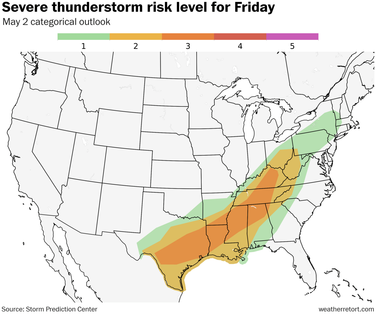
Another day of severe weather Friday.
Ian Livingston
May 02, 2025
A shifting pattern into the weekend brings a surge of heat to the East Coast before a growing rain threat with time. There’s also another round of severe weather on tap Friday.
Weather Watch
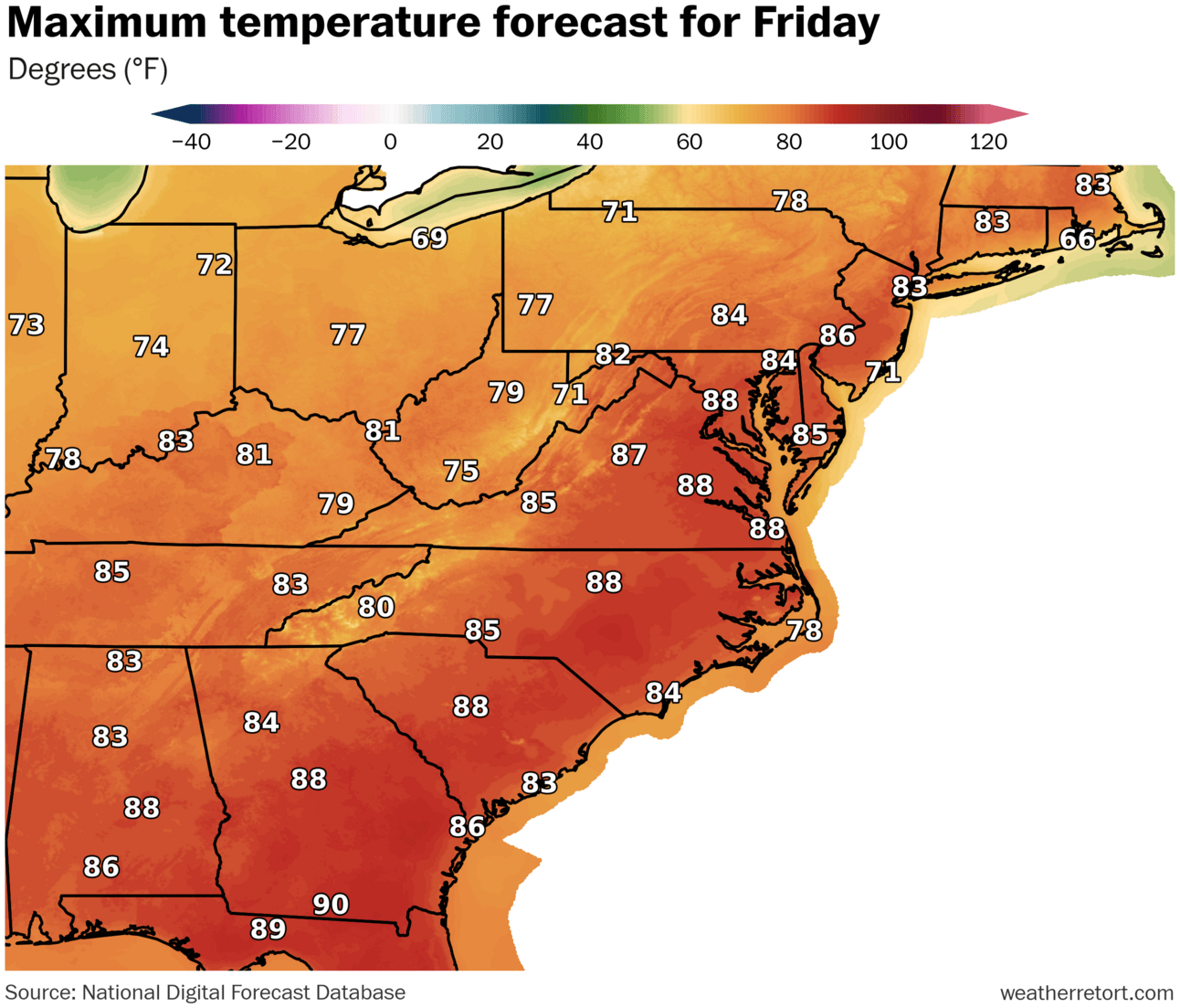
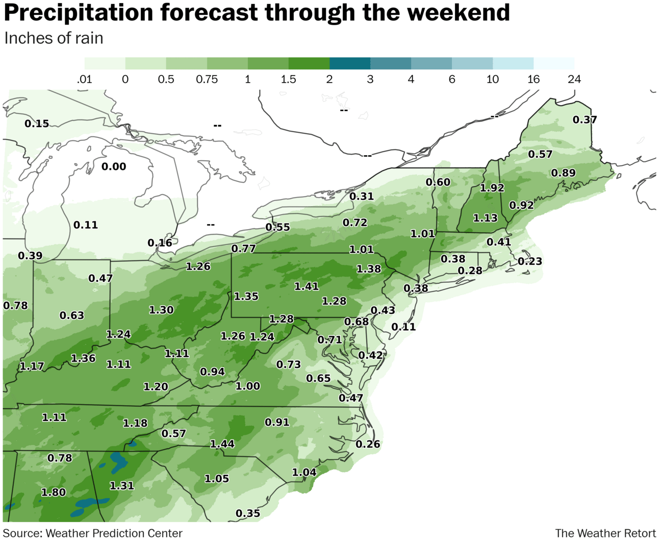
Summerlike to rainy east. Friday features the toastiest air of the year so far in much of the eastern U.S. Temperatures may approach records around D.C., as highs rise near 90 this afternoon. More warmth Saturday on the East Coast before a bit of a cooldown as rainier times arrive by Sunday.
Severe weather continues. We are now into the peak month for tornadoes in the United States, which might explain several striking twisters in Texas on Thursday with little fanfare ahead of time. Flooding rain is again swamping Oklahoma this morning; additional severe weather is expected today along a frontal zone from Ohio to Texas. There may be a relative lull this weekend before another ramp up early next week.
Lightning links
Hottest ever start to May in London as temperatures hit 29C.
The Eta Aquarids meteor shower will peak in early May.
Showers could create wet track for 151st Kentucky Derby on Saturday.
Hurricane forecasters plan big changes for famous 'cone' graphic.
Previewing the 2025 Atlantic Hurricane Season.
After 50 years of neglect, a rescued turtle finally sees the sun.
About
Weekday morning newsletter by a journalist/forecaster. Connecting weather and climate change dots while occasionally stirring the pot.
Find this interesting? Forward it on and tell a friend!
Reply