- The Weather Retort
- Posts
- Southern California flood threat takes center stage
Southern California flood threat takes center stage
There's also a storm targeting New England
Ian Livingston
November 14, 2025
I’m on the late side today as I ended up writing in depth about the flood threat unfolding through at least Saturday in southern California. This is a somewhat abridged Friday edition, focusing on storms impacting both coasts of the Lower 48.
Weather watch
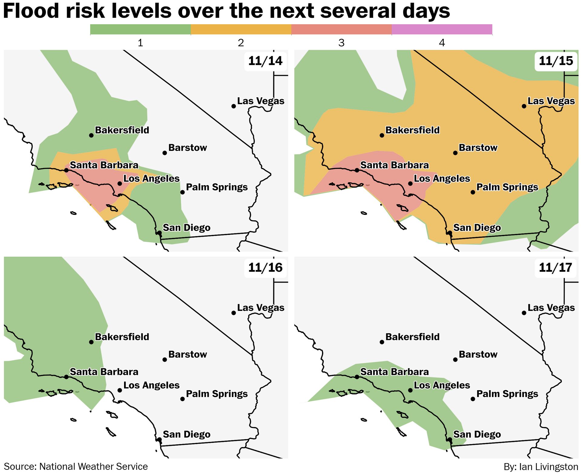
Cold November rain. The National Weather Service has the Los Angeles area and northwest under a Level 3 out of 4 flood risk both Friday and Saturday as an atmospheric river and cutoff low crash into the region. Rainfall rates up to an inch an hour at times should help a solid 3-5 inches of rain accumulate through the weekend in the area. For comparison, Los Angeles averages 0.82 inches in November — this could bump the city to the wettest month since at least 1985. A lot more detail will be available here (once it’s live).
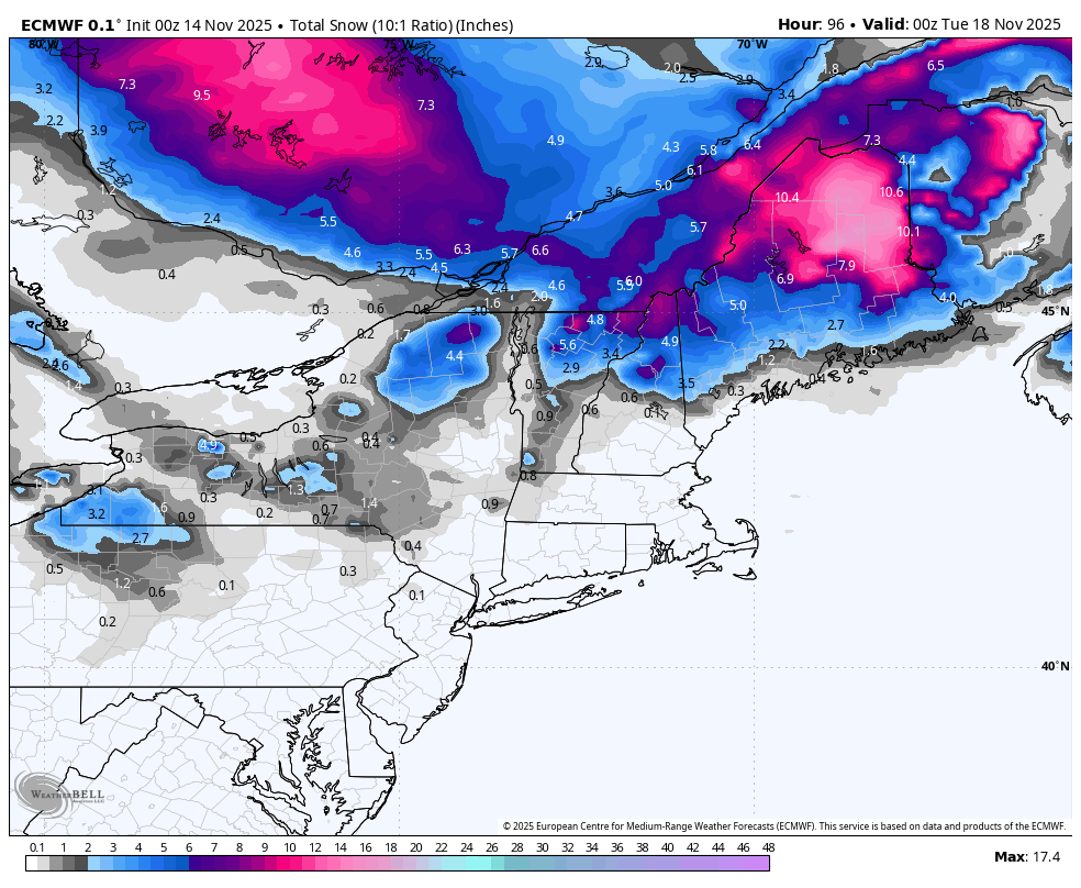
Next shot of winter. Snow and ice are in the forecast for New England and adjacent southeast Canada as a clipper-like system is expected to pass by the region this weekend. It’s a quick hitter, focusing mostly Saturday night into Sunday, though some snow lingers into Monday in Maine and perhaps downwind of the Great Lakes. Up to a quarter inch of ice accumulation is also possible from the mountains of northern New York through New Hampshire. The storm will dump another shot of cold air into the eastern U.S. as it passes.
Lightning links
Warmth to surge across central US as record-challenging temperatures unfold. (Alex Sosnowski, AccuWeather)
2 weeks after Hurricane Melissa, Jamaica is working hard to recover amid catastrophic destruction. (Hayley Vawter, FOX Weather)
Fast-moving blaze in picturesque California county damages 15 structures and prompts evacuations. (The Associated Press)
See The Moment A Landslide Smashes A Newly Built Bridge. (The Weather Channel)
About
Weekday morning newsletter by a journalist/forecaster. Connecting weather and climate change dots while occasionally stirring the pot.
Find this interesting? Forward it on and tell a friend!
Reply