- The Weather Retort
- Posts
- Series of West Coast storms will pile up the rainfall
Series of West Coast storms will pile up the rainfall
A storm off the East Coast is also about to bomb.
Ian Livingston
November 03, 2025
We open the work week with storms on both coasts. West Coast storminess will keep on going through the week. Low pressure off the Mid-Atlantic is headed for big things near Newfoundland.
Weather watch
Waves of rain. Several storms and their attached atmospheric rivers will hit the West Coast this week. The first wave pushes ashore Monday into Tuesday, with a larger event poised to hit on Wednesday, then another right on its heels for late week. Over the next seven days, a large swath from southwest Canada to northern California will see at least 3 to 6 inches of rain and sometimes more. These systems will be somewhat mild so snowfall will focus north of the main atmospheric river zone in Canada and only the very highest peaks from Washington to California.

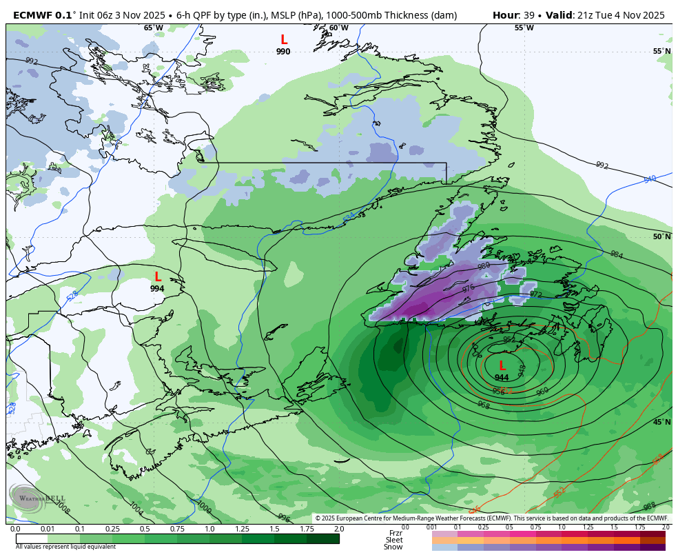
Bombogenesis. A coastal storm getting going off the Mid-Atlantic is throwing some moisture at that region and northward to New England through Monday. As it moves northeast it will “bomb out” headed toward the Canadian Maritimes. By late Tuesday, it could be quite close to Newfoundland, bringing heavy rain near shore and the potential for white out conditions inland. The European model, shown below, has the system reaching the mid-940s for millibars — quite intense!
Lightning links
Thousands evacuated as typhoon bears down on Philippines. (Agence France Presse)
Caribbean being monitored for new tropical development in November. (Alex Sosnowski, AccuWeather)
Waters Turn Bright Green At Popular Vietnam Beach. (The Weather Channel)
About
Weekday morning newsletter by a journalist/forecaster. Connecting weather and climate change dots while occasionally stirring the pot.
Find this interesting? Forward it on and tell a friend!
Reply