- The Weather Retort
- Posts
- Relief into the weekend, but still summery most spots
Relief into the weekend, but still summery most spots
Atlantic Ocean off to a slowish start. Meaningful?
Ian Livingston
June 27, 2025
The fever has broken in this round of extreme temperatures. Today’s high in Boston is expected to be about 30 degrees cooler than what was seen earlier in the week! Low 70s and sun will probably be quite the treat there.
Weather Watch
Slow start in Atlantic. Despite Andrea’s brief appearance this week, the story of the Atlantic hurricane season remains a dull one at this early date. Does it mean anything? I addressed that on Thursday. (tl;dr … not really). The eastern Pacific is now also on the cusp of its next storm and forecasters are currently monitoring potential development in the Atlantic as the month ends and July begins.
Lightning links
Lightning struck the Washington Monument last night.
Likely tornado lifts Florida house on its end, sets it back down.
Up-close encounter with dual waterspouts wows Florida boaters on river.
Fireball meteor believed to have crashed into Georgia home after sending shockwaves across Southeast.
And now, a slight breather…
Widespread record-breaking heat of recent days in the eastern U.S. is done for this wave.
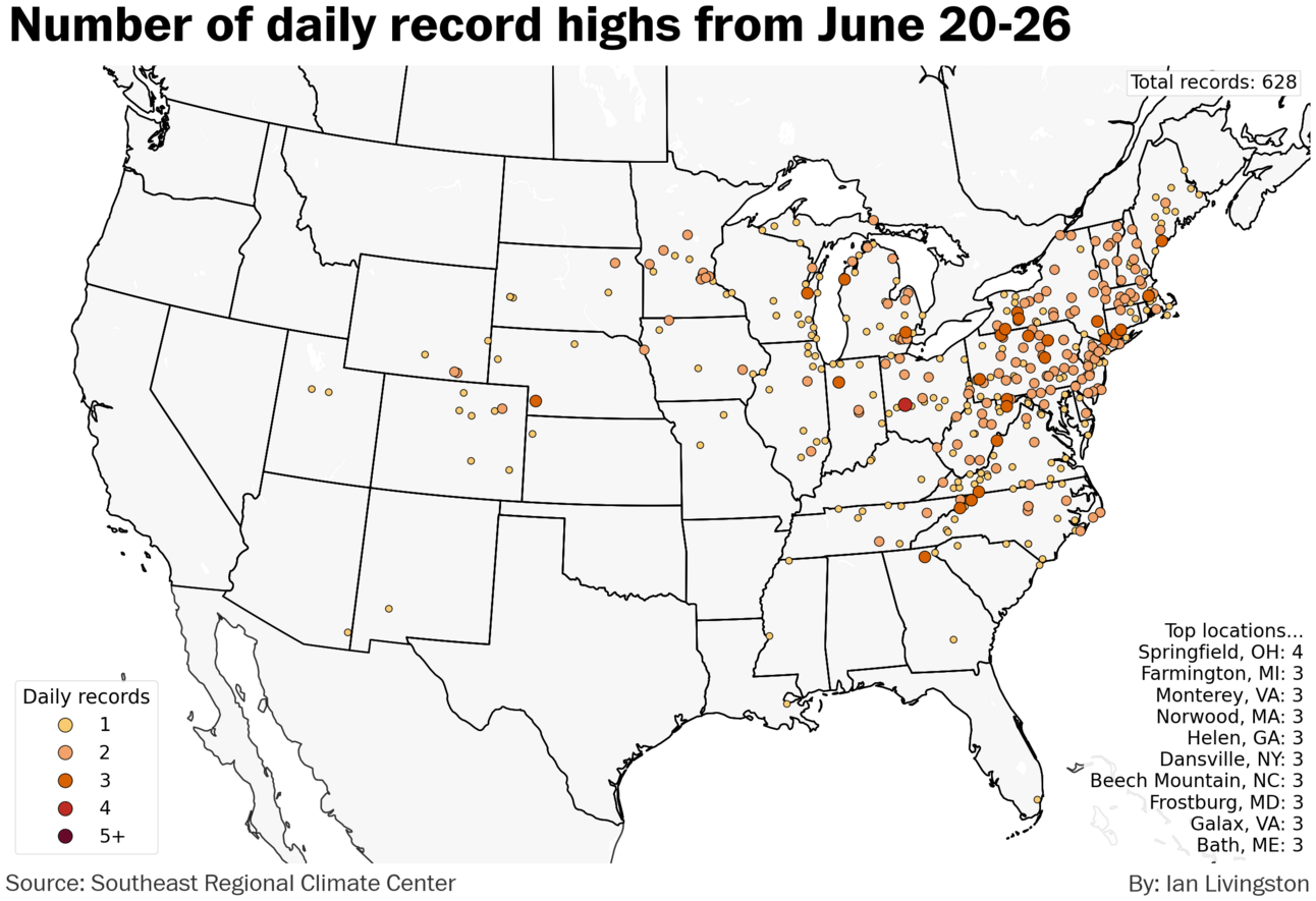
More than 2,500 record highs and record warm lows were established over the week ending Thursday, according to Southeast Regional Climate Center data.
Although the extreme heat is gone for now, more typical summertime temperatures are expected to persist along with pockets of potentially hazardous temperatures in the Midwest and Mid-Atlantic to the Mid-South.
About
Weekday morning newsletter by a journalist/forecaster. Connecting weather and climate change dots while occasionally stirring the pot.
Find this interesting? Forward it on and tell a friend!
Reply