- The Weather Retort
- Posts
- Punishing heat in the Northeast on Tuesday with squeeze play underway
Punishing heat in the Northeast on Tuesday with squeeze play underway
Many people are waiting on hurricane season. It's coming.
Ian Livingston
July 29, 2025
We’ve got a couple more days of high heat covering much of the eastern U.S. And as July winds down, the waiting game for the peak of hurricane season is almost over.
Weather watch
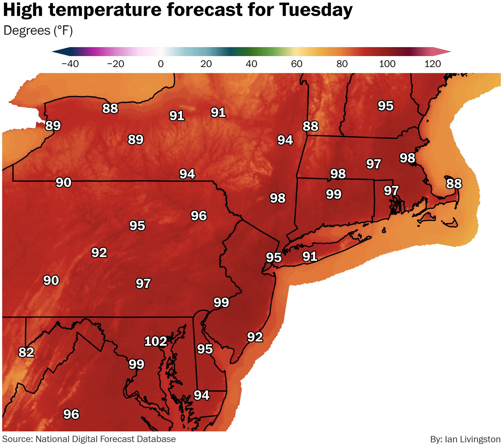
Heat footprint begins shrinking … but. Heat alerts are down in number Tuesday — they still include about half the U.S. population. Highs in and around New York City are expected to reach 95-100 today and Wednesday, which has sparked an excessive heat warning in parts of northern New Jersey. A cold front pushing through the Midwest and Great Lakes region will continue to squeeze heat south and east through the end of the week.
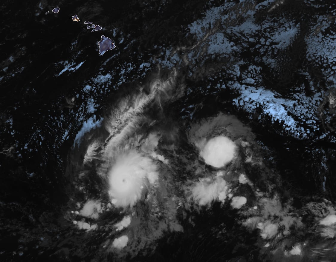
Storm train. The Pacific Ocean is awake and pumping out the storms once again. Keli developed Monday immediately on the heels of major hurricane Iona (see the trailing blob below). Iona is now expected to peak around 130 mph. More fish storms are likely to spin up ahead.
Lightning links
Streets turn to rivers as deadly flooding inundates northern Beijing. (Nectar Gan and Joyce Jiang, CNN)
Navy Set to Unplug Critical Hurricane Satellites this Week. (Michael Lowry, Substack)
More northern Plains tornadoes (and a lightning-sparked fire) on Monday. (Reed Timmer, YouTube)
Tampa heat index hit 120 on Monday, with a dew point of 83. (Jeff Berardelli, BlueSky)
Clouds flow over Mount Adams in Mount Washington timelapse. (Mount Washington Observatory, YouTube)
Tick, tick, tick, tock …
Here comes the ramp up.
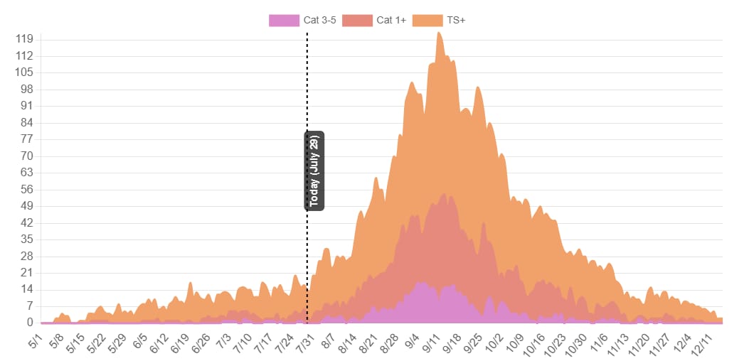
The Atlantic hurricane season has so far been unremarkable, but we’ve barely gotten started. While storms can and do occur for about half the year, most of them do so from August through October.
As in the world of weather averages, conditions in the present are becoming increasingly favorable for development potential, both now and into the future. Weather models are also starting to spin up various phantom threats at range — not something to focus on, but a sign that times are changing.
About
Weekday morning newsletter by a journalist/forecaster. Connecting weather and climate change dots while occasionally stirring the pot.
Find this interesting? Forward it on and tell a friend!
Reply