- The Weather Retort
- Posts
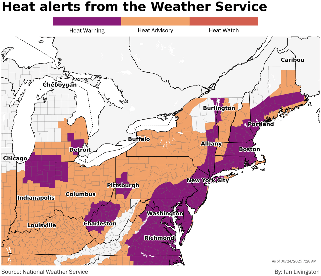
- Near and past 100 Tuesday in D.C., NYC and Boston
Near and past 100 Tuesday in D.C., NYC and Boston
A second day of extreme heat on the East Coast.
Ian Livingston
June 24, 2025
Dangerous heat has a grip on the East Coast Tuesday as extreme heat warnings run up and down the region. More is expected through Wednesday.
Weather Watch
Heat alert. What should be the hottest day of the current heat wave for many in the Interstate 95 corridor, temperatures rise near and above 100 from North Carolina to Southern New England this afternoon. Excessive heat warnings are in effect for 75 million with another 75 million under heat advisory. Dozens of records again anticipated.
Ring of fire. A frontal zone and some monsoon moisture stuck near the edge of our eastern U.S. heat dome is putting out areas of heavy rain from New Mexico to the Great Lakes over coming days. There’s a Level 3 of 4 flood threat for much of New Mexico on Tuesday, where 1-4 inches of rain is in the forecast and flood watches are in effect. Flooding hit Ruidoso on Monday.
Summer opens with killer tornadoes
Multiple tornadoes struck North Dakota late last Friday at the same time a derecho swept the state and eventually ran into the tornadic supercells.
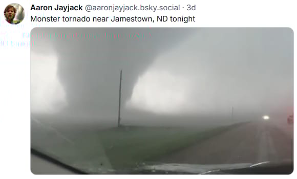
The strongest twister was rated EF3. It didn’t hit much but tossed train cars off the tracks, so it was seemingly quite intense.
Three were killed by that tornado, when it impacted parts of Enderlin, a bit less than an hour from Fargo. It was the first multi-fatality tornado in the state since 1978.
Related to the same atmospheric disturbance riding atop high pressure, a line of storms dropped into New York Saturday night.
During the pre-dawn Sunday, it dropped an EF1 tornado that killed three, which places the tornado among the top several deadliest on record in the state and makes it the deadliest since 2014 there.
About
Weekday morning newsletter by a journalist/forecaster. Connecting weather and climate change dots while occasionally stirring the pot.
Find this interesting? Forward it on and tell a friend!
Reply