- The Weather Retort
- Posts
- Multiple storm systems to hit West Coast and California
Multiple storm systems to hit West Coast and California
And it's a windy end to the work week for the Northeast.
Ian Livingston
December 19, 2025
The final weekend to grab all those last-minute gifts won’t be weather free, but it could be considerably worse. Most of the significant weather will focus on the western U.S. after a cold front shifts off the East Coast today.
Weather Watch
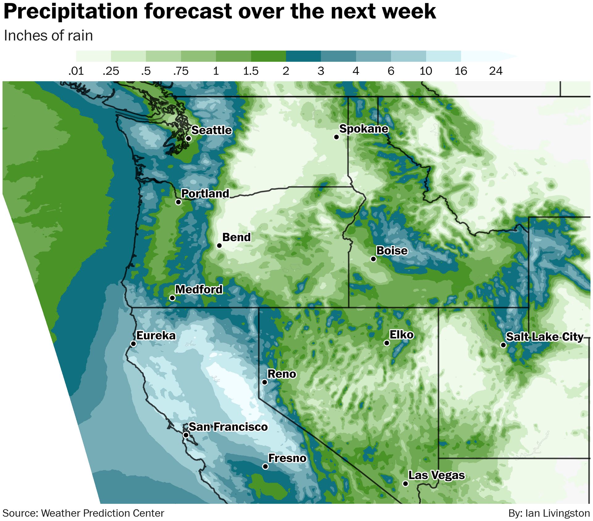
Wet West Coast. New atmospheric rivers are targeting the West Coast after prolific flooding in Washington over the past week or so. The action shifts south, focusing on Oregon and California. Heavy rain will hit that region Friday, dropping up to 2-4 inches and high elevation snow. Bigger storms will center on northern California — particularly around San Francisco — early next week. With a connection to the tropics, totals could be extreme in some locations. With time, rain will also shift toward southern California by mid- to late next week.
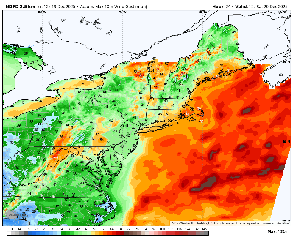
Gusty winds. The Northeast will face strong winds through Friday behind a strong cold front exiting the East Coast. A powerful storm system in southeast Canada is tightening up a pressure gradient which will help the gusts roar. Wind advisories or high wind warnings are in effect for all of New England and New York, as well as much of the Mid-Atlantic, for gusts of at least 45 to 55 mph with some higher wind speeds possible.
Lightning links
Deadly windstorm packs gusts over 140 mph, knocking out power in Northwest, Rockies. (Jesse Ferrell, AccuWeather)
Blizzard conditions lead to near-zero visibility in Minnesota. (Hayley Vawter, FOX Weather)
'Once in a generation' weather turns Saudi desert completely white with snow. (Edward Easton, The Mirror)
Hundreds of Satnas hit the slopes in Maine. (AccuWeather)
About
Weekday MWF morning newsletter by a journalist/forecaster. Connecting weather and climate change dots while occasionally stirring the pot.
Find this interesting? Forward it on and tell a friend!
Reply