- The Weather Retort
- Posts
- Inauguration set to be cold day in hell, following possible Sunday snowstorm
Inauguration set to be cold day in hell, following possible Sunday snowstorm
Arctic air begins pouring south of the international border Friday.
Ian Livingston
January 17, 2025
It’s been a memorably cold January across a big chunk of the contiguous United States, and the most intense outbreak yet is on our doorstep. The latest Arctic invasion is also targeting the inauguration of incoming President Donald Trump with obscene chill. There could even be fresh snow on the ground, and blowing around, from the day prior.
Weather Watch
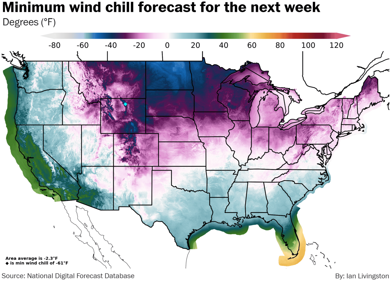
Arctic blast cometh. The most significant batch of cold air this winter is inbound to the Lower 48. Entering the Plains Friday, it will make it to the East Coast by Sunday. Temperatures are currently forecast by the Weather Service to fall as far as minus-40 in Colorado. Widespread wind chills of minus-20 to minus-50 or colder will cover the northern tier, including Minneapolis, Chicago and Pittsburgh. Unlike the typical cold shot these days, this one is also set to establish a number of new records.
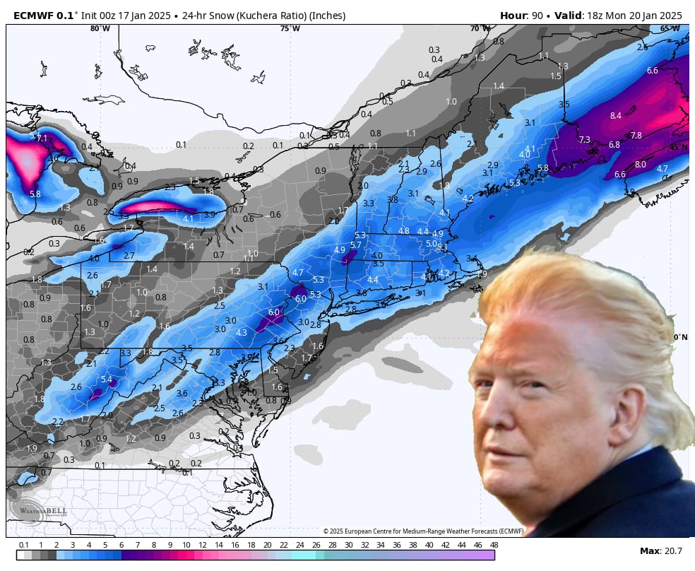
Sneaky Sunday snow. In what is becoming a wintry month like the old days for parts of the region, a potentially moderate snowstorm has sprung up Saturday night through Sunday night for the Mid-Atlantic and Northeast. Early Friday’s National Blend of Models was indicating around 2 inches for D.C., but the latest morning weather models generally suggest a 2-to-6-inch type event from Washington to Boston. The American GFS delivers a foot or so to a big chunk of New England. The European, below, is a bit more modest.
Frozen MAGAritas. The noontime swearing in Monday is forecast to see a temperature near 21 degrees and a wind chill around 9 degrees in D.C. Ronald Reagan would have faced a noon temperature of 7 degrees in 1985, if the ceremony was not moved indoors. During 1961 John F. Kennedy was sworn in alongside a 22-degree temperature. The most recent memorably cold inauguration was Barack Obama’s in 2009, when it was 28 degrees at noon.
I’m issuing a preemptive “where’s the global warming?” warning for Newsmax.
Lightning Links
It’s the first day since Jan. 6 without a highlighted fire weather risk in Southern California, but critical fire weather is expected to return next week.
We’re moving into the peak of major Northeast snowstorm season.
In a throwback to the ‘blue shed’ of Hurricane Harvey, check out the VW bus ‘Azul’ that survived California’s firestorm.
Planet-warming gas levels rose more than ever in 2024.
About
As a forecaster, journalist and certified weather freak (there's a badge, trust me), a big part of my job is analyzing the playing field of global weather and related climate change stories to decide which ones to spend more time on.
In this every-weekday newsletter, and generally in 500 words or fewer, I'm going to bring that directly to you.
The Weather Retort is part of a larger project I am spinning up that will offer focused, informed, and personalized weather and climate data for you and/or your business.
Forward this on and tell a friend!
Reply