- The Weather Retort
- Posts
- Hot in Pacific Northwest but first taste of fall much of Lower 48
Hot in Pacific Northwest but first taste of fall much of Lower 48
Flood risks may pop up in various places, too.
Ian Livingston
August 25, 2025
We’re kicking off this week with a cold front sweeping any summerlike air from much of the eastern half of the United States. Places near where that front gets hung up may see some hefty rainfall in days ahead, especially in parts of the southern Plains region and back to the Intermountain West.
Weather watch
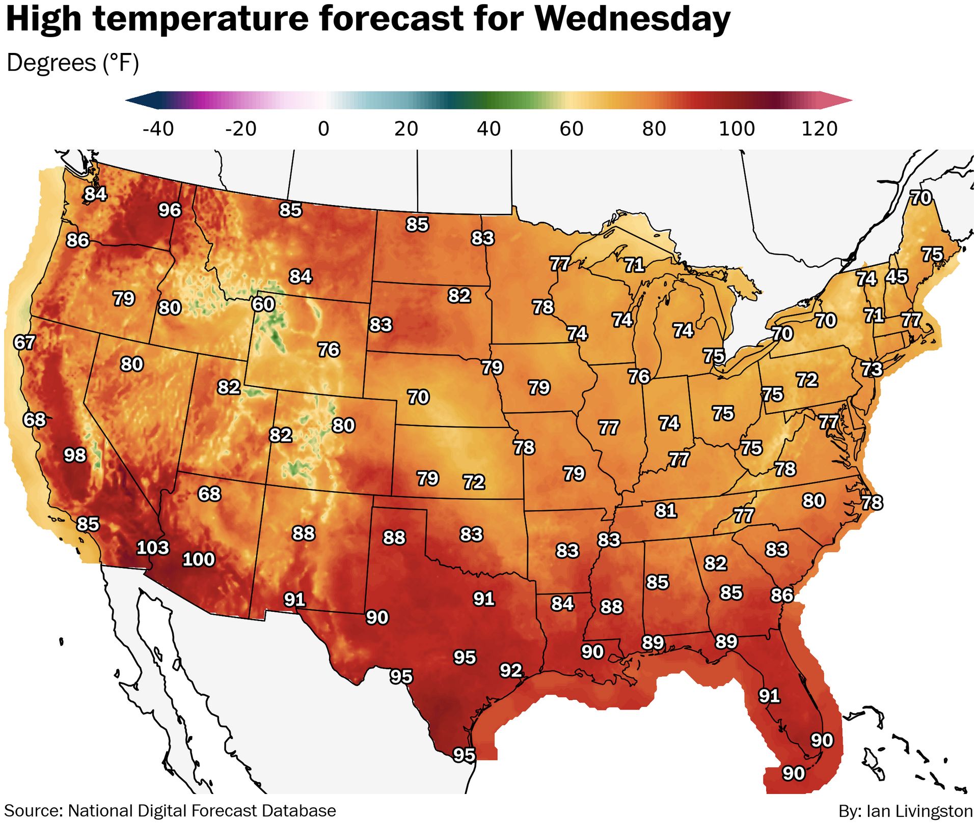
Extreme Northwest heat. High levels of heat persist in the Pacific Northwest and California to open the work week. Heat warnings include Portland and Seattle through Tuesday, where highs are forecast to reach the low 90s in the former and upper 80s in the latter. Portions of the same zone are also under red flag warning where there are wildfires ongoing and risk for more.
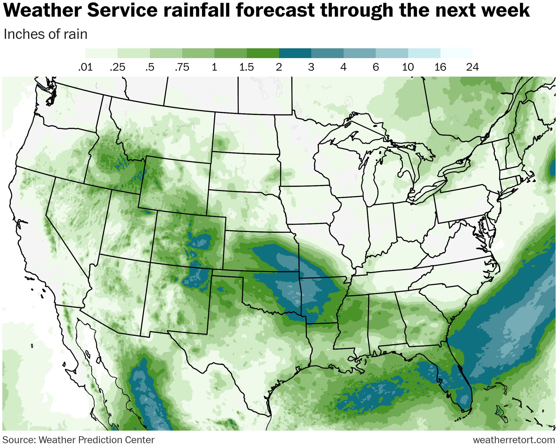
Assorted flood risks. Flood watches are in effect on the southern Plains, across portions of Oklahoma, Kansas and into the Texas panhandle, for potential of 1-4 inches of rain. Additional zones of flooding are possible in the eastern half of New Mexico and Colorado, California and Nevada, plus portions of the Southwest. There’s also a blowing dust advisory for southern Arizona where monsoonal showers and thunderstorms are kicking stuff into the air.
Lightning links
Fernando formed over the weekend east of Bermuda. (National Hurricane Center)
Heatwave that fueled deadly wildfires was Spain’s ‘most intense on record’. (Agence France-Presse)
Floods keep ravaging Pakistan - how can it protect itself? (Azadeh Moshiri, BBC)
Dust storm flips tents at Burning Man as forecasters warn of looming flood danger. (Susie Neilson and Anthony Edwards, San Francisco Chronicle)
Monday morning weather maps
As advertised on Friday, low temperatures in Badwater Basin, Death Valley only fell to 101 Saturday morning. It’s extremely rare to be so hot for a low, especially this late in the year, even in Death Valley.
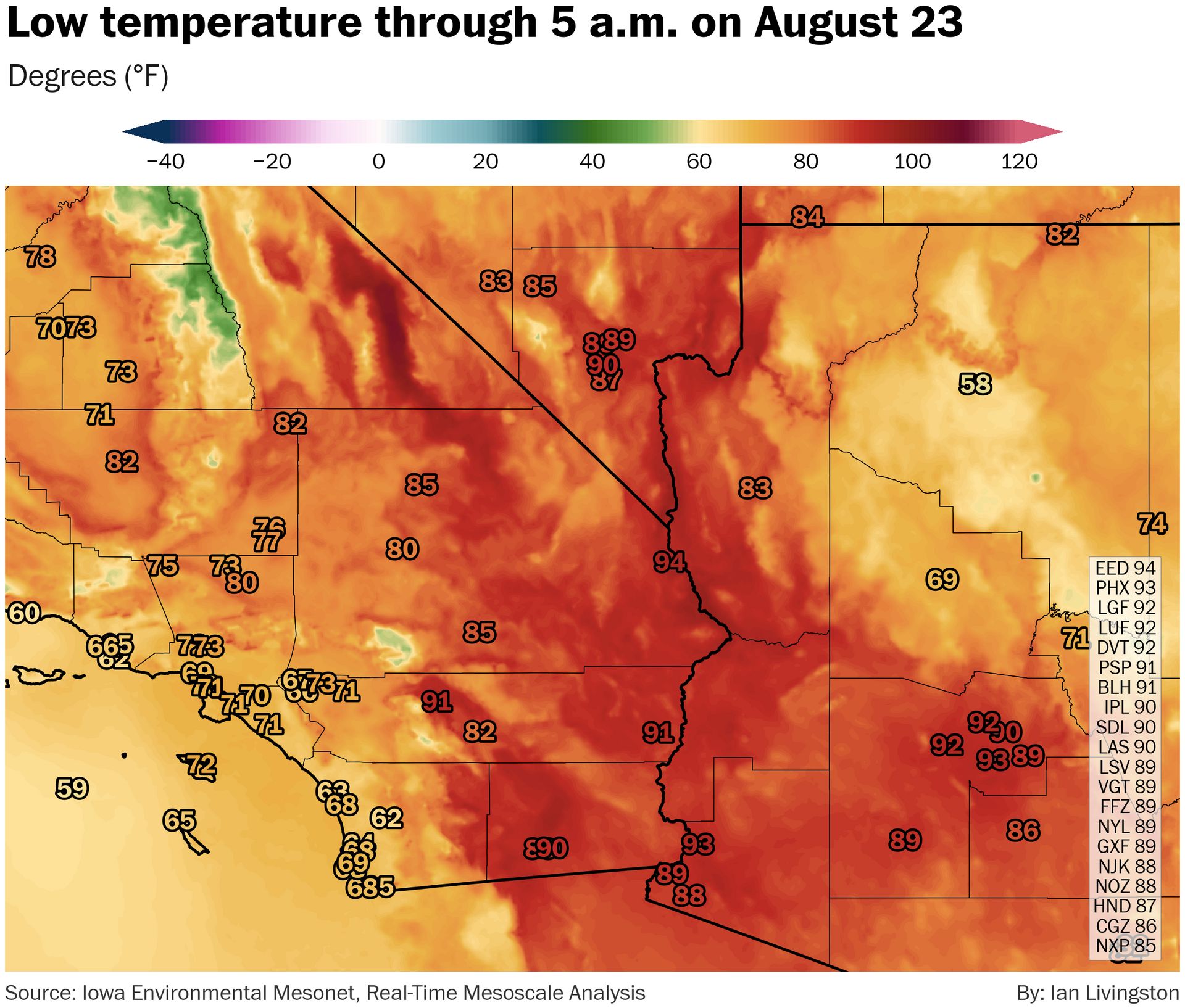
It also reached 124 — for a third time in 2025 — in the valley on Friday. It remains the hottest observed temperature for the country this year.
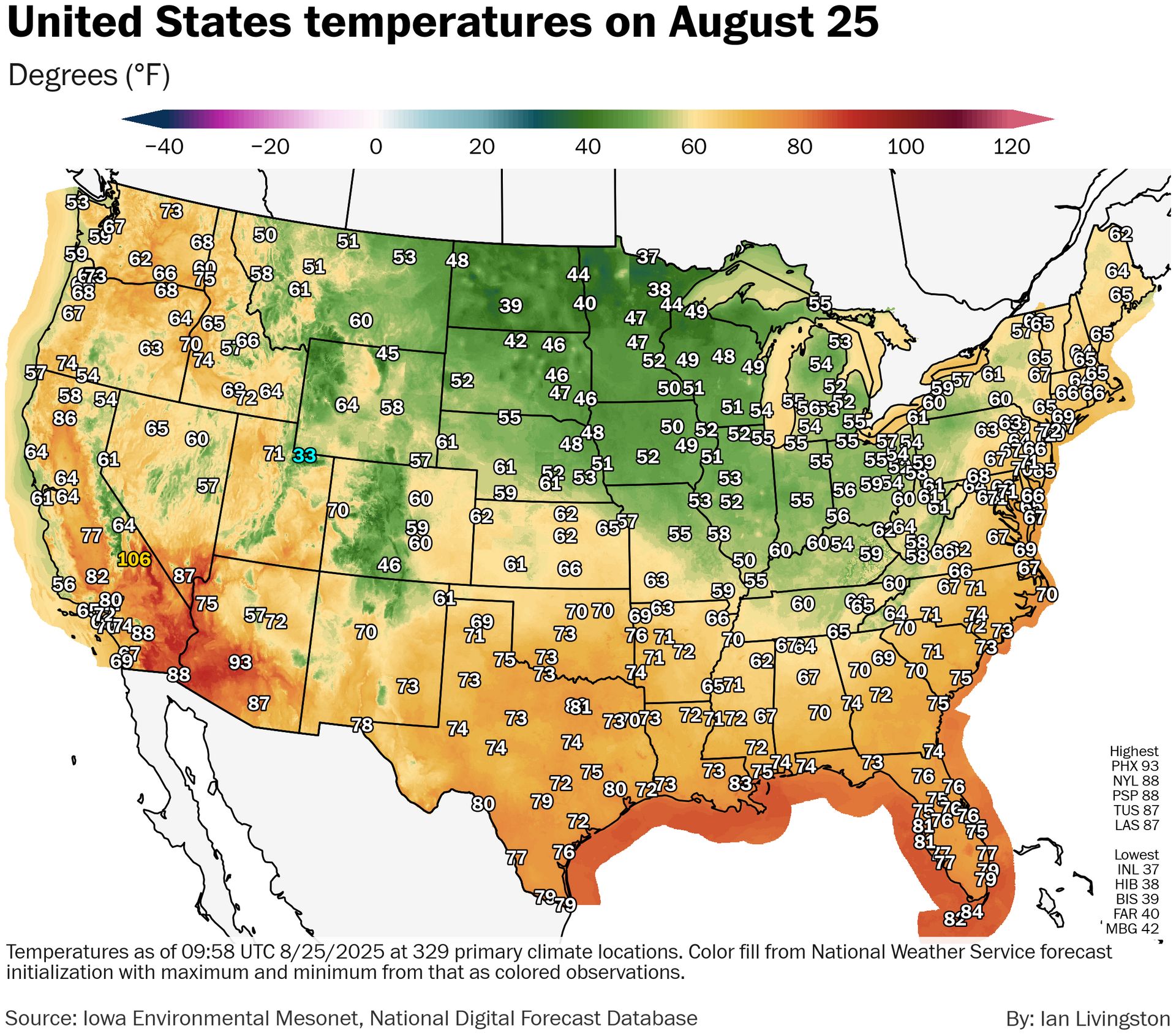
Meanwhile, there was a frost advisory up for parts of Minnesota Monday morning as a cool air mass takes over across the eastern half of the Lower 48. International Falls, in northern Minnesota, was down to at least 37 for a low.
The cool air is promising a beautiful stretch for many places, including my backyard in D.C. where highs are supposed to be in the 70s most of the week. Not too atypical for weather in September, but a bit early in this case.
About
Weekday morning newsletter by a journalist/forecaster. Connecting weather and climate change dots while occasionally stirring the pot.
Find this interesting? Forward it on and tell a friend!
Reply