- The Weather Retort
- Posts
- Heat building in central U.S. as new Atlantic disturbance emerges
Heat building in central U.S. as new Atlantic disturbance emerges
On 9/11/01, Hurricane Erin was spinning off the New York coast.
Ian Livingston
September 11, 2025
We’re digging deep to find much of consequence in the weather world at the moment. I can only recall a few — at most — similar stretches in recent times. Maybe the lack of weather is itself a story?
Weather Watch
Atlantic disturbance. We’re going to give it another go. A wave south of the Cabo Verde islands in the eastern Atlantic has a 30 percent chance of development over the next week. Conditions are generally more favorable than they have been, but that’s not yet a guarantee of anything big to track.
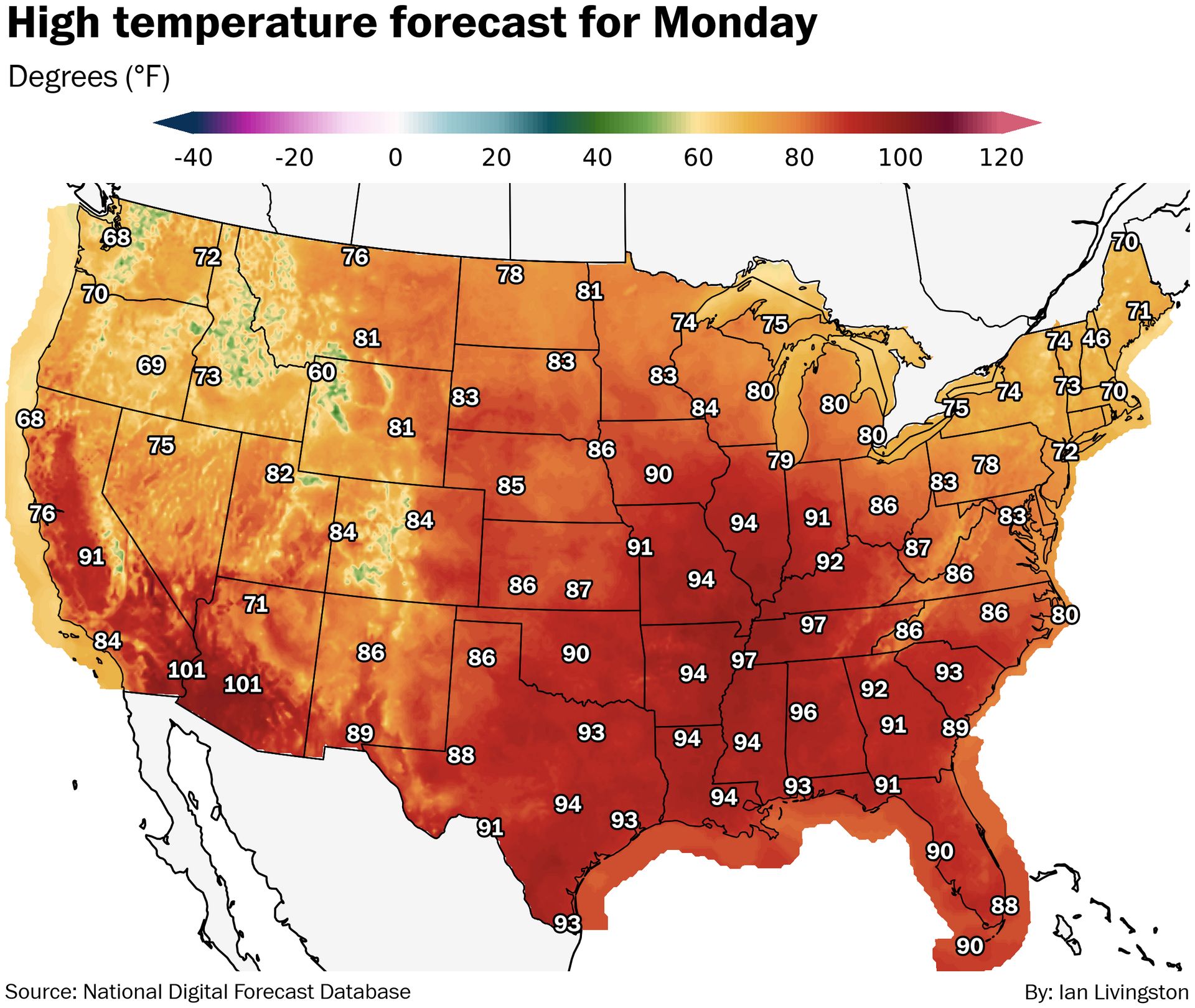
Heat surge. Summer is running low on time but a heat blast coming to the central U.S. through the weekend. Highs in the mid- and upper 90s should get as far north as Missouri and Illinois over coming days, lasting into early or mid- next week. Some zones of major heat risk are anticipated.
Lightning links
Did your area just have its most humid summer? Find out here. (Ben Noll and Daniel Wolfe, The Washington Post)
Wisconsin Tree Hit By Lightning Explodes Into Flames. (The Weather Channel)
The last Hurricane Erin
Before this year’s Category 5 Hurricane Erin, the last time a storm with the name reached hurricane status was in 2001. On this tragic day 24 years ago, Erin was spinning off the coast of New York, missing land and a chance to alter history by about 500 miles.

About
Weekday morning newsletter by a journalist/forecaster. Connecting weather and climate change dots while occasionally stirring the pot.
Find this interesting? Forward it on and tell a friend!
Reply