- The Weather Retort
- Posts
- Flood risk in the Mid-Atlantic to open July
Flood risk in the Mid-Atlantic to open July
A cold front is sweeping across the East Coast.
Ian Livingston
July 01, 2025
A cold front working its way through the eastern U.S. is set to spark an active day in the Mid-Atlantic. It’ll set the stage for a comparably tranquil Fourt of July in the region. It’s also been a hot start to summer so far in the Northeast.
Weather Watch
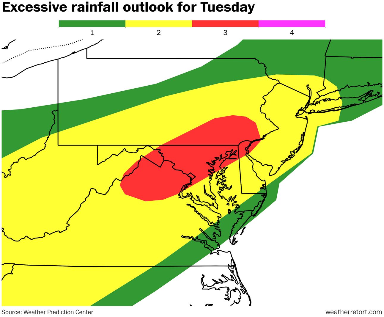
Mid-Atlantic rain. After a year of drought, the past two months have been very wet in the Mid-Atlantic. A Level 3 of 4 flood risk covers parts of that region today, including my backyard in D.C., where rounds of storms could roll through and deliver several inches of rain in a short period. Severe storms are also a possibility.
Flossie. The sixth named storm of the year in the eastern Pacific became a hurricane over the past day. It’s now forecast to reach just shy of a Category 3 major hurricane on Wednesday, before running into cooler water and weakening over the open ocean.
Lightning links
Wimbledon opening day hottest on record. (Emine Sinmaz and Geneva Abdul, The Guardian)
SoCal wildfires spread fast, force evacuations. (The Weather Channel)
Summer starts with a hot June
The first month of climatological summer is behind us. Long-term stations that observed their hottest June on record include:
Raleigh, North Carolina at 81.6 degrees
Islip, N.Y. at 72.2 degrees
Many more locations in the northeast quadrant of the Lower 48 finished with a top 5 warmest June, including: Atlantic City, New York Kennedy, Beckley, W.V. and Washington Dulles.
About
Weekday morning newsletter by a journalist/forecaster. Connecting weather and climate change dots while occasionally stirring the pot.
Find this interesting? Forward it on and tell a friend!
Reply