- The Weather Retort
- Posts
- Extreme heat invades eastern U.S.
Extreme heat invades eastern U.S.
The tropics continue to spit out storm chances, too.
Ian Livingston
June 23, 2025
Air conditioning is on never-stop mode for much of the eastern U.S. through the workweek as the most punishing heat of summer so far blasts the region. On Monday, the urban Interstate 95 corridor could be among the hottest places in the country.
Weather Watch
Extreme heat. More than 150 million people are under heat alerts Monday as high pressure exerts control over the eastern United States. Extreme heat warnings include Washington, Philadelphia, New York City and Boston, with extreme heat watches into Maine. Dozens of record highs and record warm lows are expected daily through midweek.
Tropics. The Atlantic Ocean may finally join the party with its first storm of the season. If so, it won’t amount to much as it’s already 500 miles east of Bermuda. Meanwhile, the eastern Pacific seems ready to spin up another.
Lightning links
Cold summer squalls capsized boats on Lake Tahoe Saturday, leaving at least six dead.
Summer solstice from space.
Monday morning weather maps
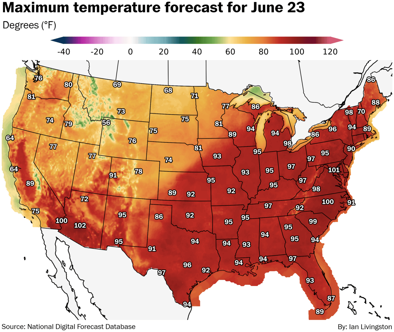
The heat is on from the Great Lakes to Mid-Atlantic and Northeast. It almost always takes near-perfect conditions to get to 100 in the Interstate 95 corridor, but a number of spots from D.C. to NYC should make a run.
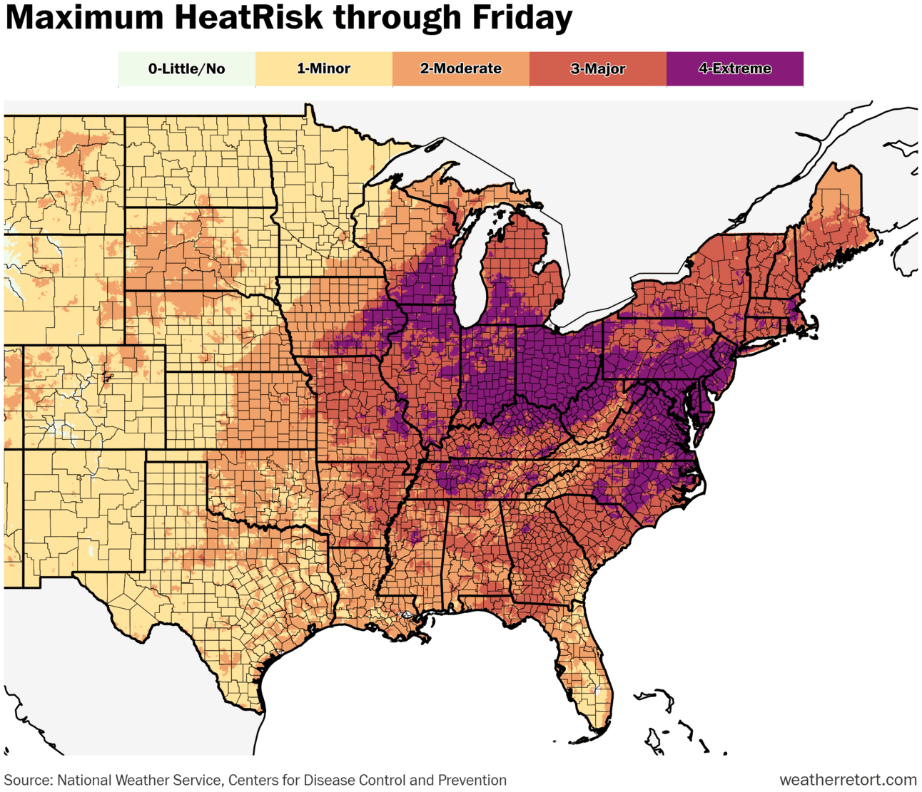
Extreme HeatRisk will be commonplace over the next several days across the same region. On Monday, it also includes Chicago and much of the Ohio Valley.
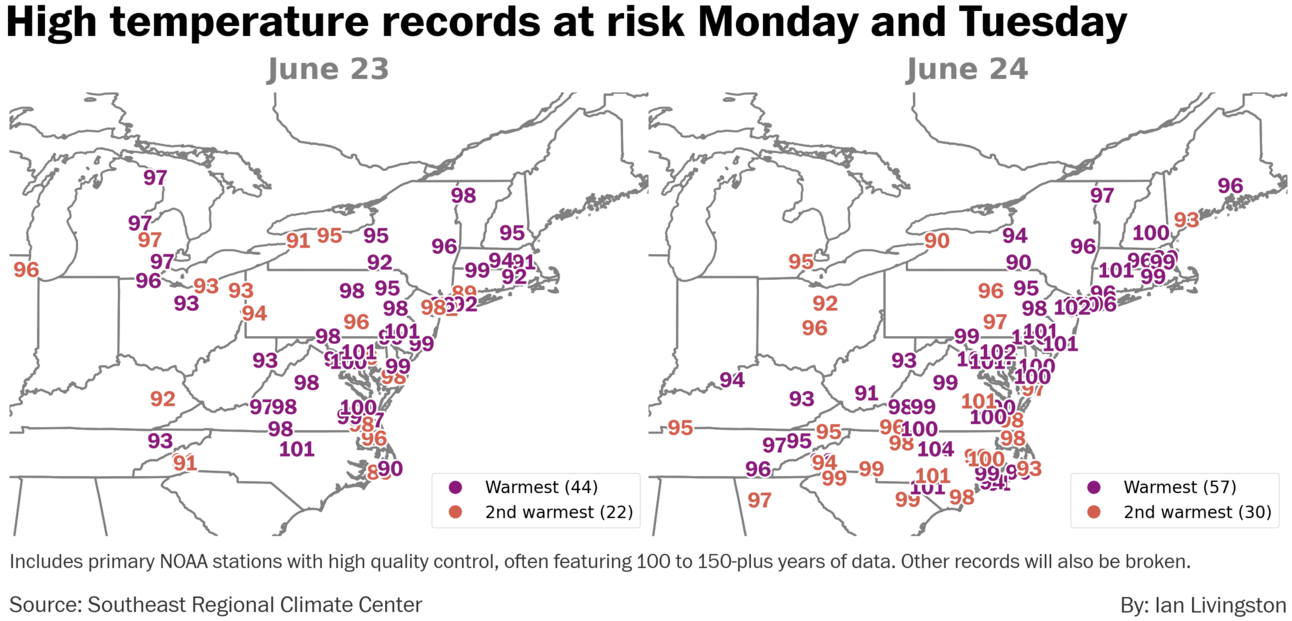
Lots of records are in play across the Mid-Atlantic and Northeast, in particular. In addition to the record highs below, a similar or greater amount of record warm lows are likely.
About
Weekday morning newsletter by a journalist/forecaster. Connecting weather and climate change dots while occasionally stirring the pot.
Find this interesting? Forward it on and tell a friend!
Reply