- The Weather Retort
- Posts
- Eastern storm frustrates forecasters amid deluges in Southwest
Eastern storm frustrates forecasters amid deluges in Southwest
It's also the coldest morning of this stretch in the Northeast.
Ian Livingston
October 10, 2025
Eyes are on the U.S. East Coast and Desert Southwest through the weekend as copious moisture gathers around both regions. The coastal set to plague the east is still rather hard to figure out…. a sign of the coming La Niña cold season?
Weather watch
Western storminess. Priscilla is weakening west of Baja California as Raymond heads that direction. Both — plus old remnants of Octave — are pumping moisture into the Four Corners region. On Friday, a Level 3 out of 4 moderate risk of flooding covers a large portion of northern Arizona and another zone in southern Utah. More heavy rain is on tap this weekend.
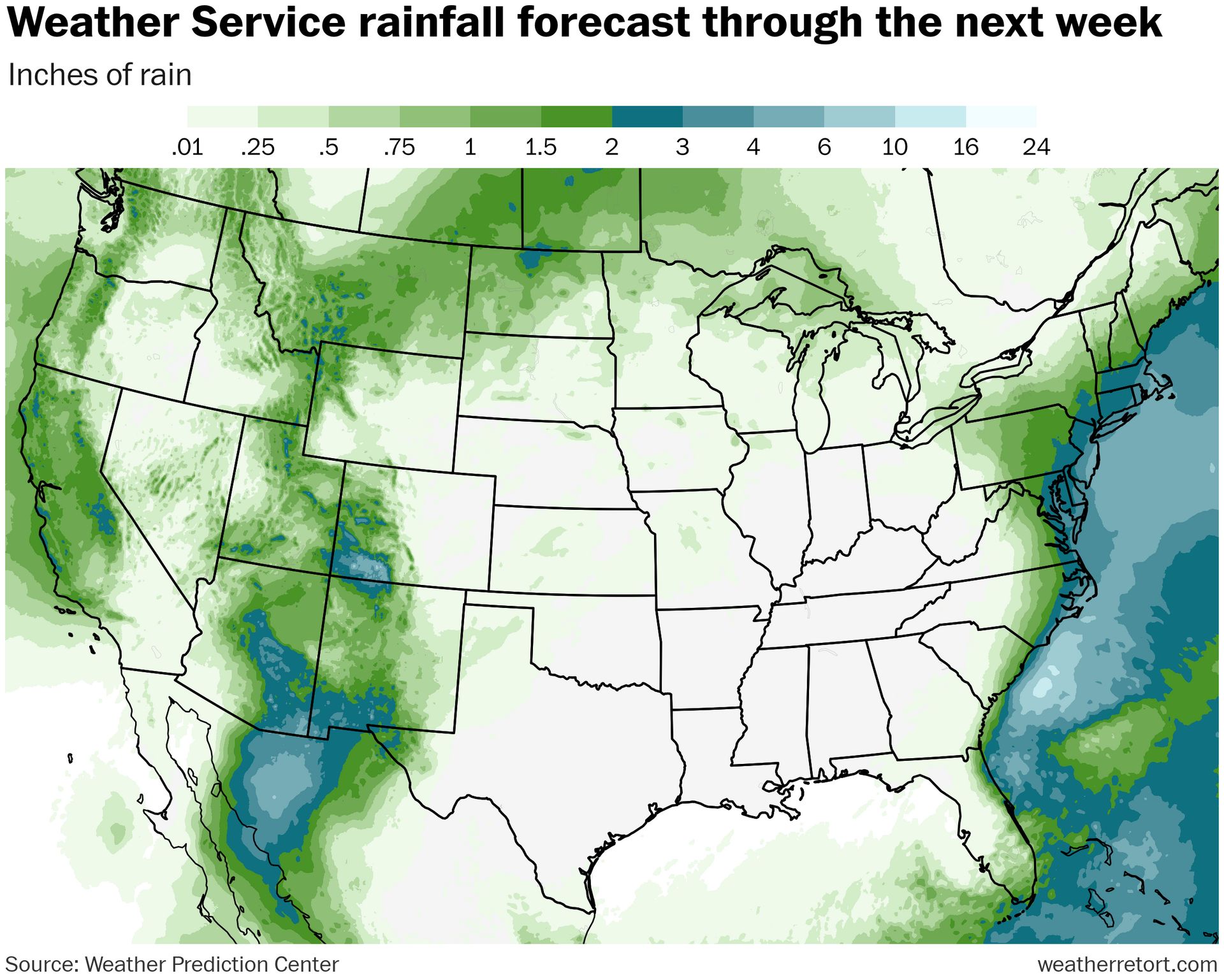
East Coast storm. This one remains rather convoluted. A day closer there’s still plenty of question as to wtf is going on here — there should be a slow-moving low offshore, but how much rain it brings to many spots is very up in the air. Right now, the coastal Carolinas and Southern New England seem most primed for heavy rain with the Mid-Atlantic still a question mark given positioning of the low and interactions in the jet stream aloft.
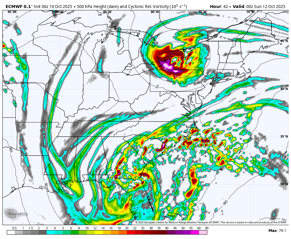
Two zones of upper-level storminess… runs with super-wet solutions merged the two with a slower northern bowling ball. More recent runs do not do this as much or at all, keeping the Mid-Atlantic much drier. The latter is probably a favored solution though some rain should fall.
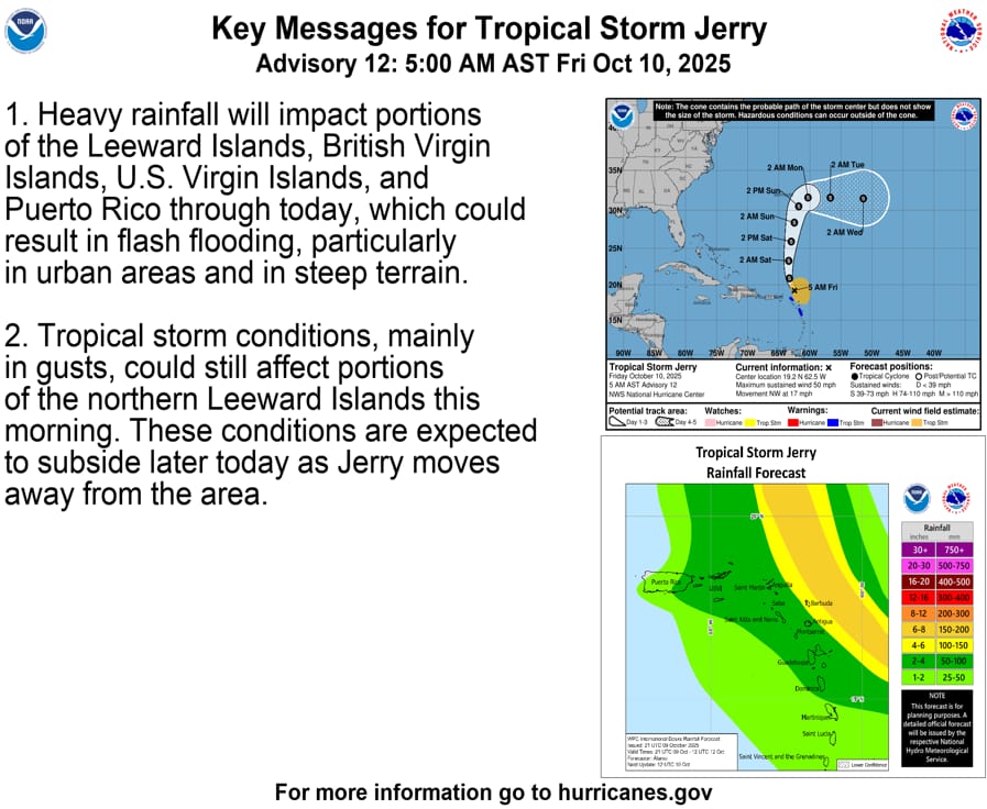
Tropics. Karen developed in the far north Atlantic overnight and immediately asked to see the manager. Well to the south, Jerry is making its closest pass to the Leeward Islands, the Virgin Islands and Puerto Rico — all could see heavy rain and even some localized flooding Friday. Jerry is now forecast to remain a tropical storm, and it has struggled thus far.
Lightning links
What the Pacific ‘blob’ + La Niña means for winter in the US. (Andrew Freedman, CNN)
Farmers suffer second-worst harvest on record. (Patrick Galbraith, The Telegraph)
Have another cold one
It’s Friday and it’s 5 o’clock somewhere.
Err, this is about temperatures. We’re starting the day frozen in much of New England and New York away from the coast.
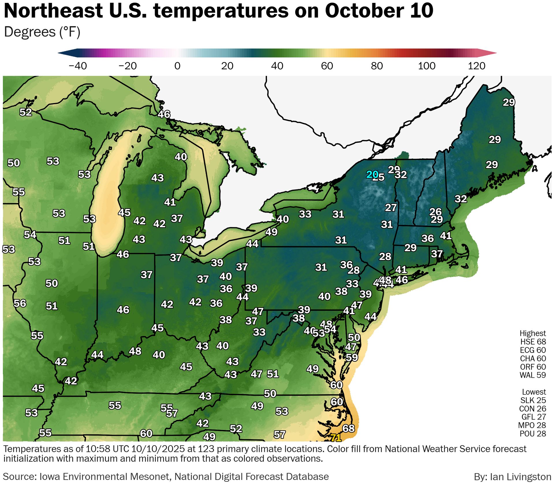
Hartford was down to at least 29, with Albany checking in at 31. Poughkeepsie dipped to at least 28. The big cities from Boston to Baltimore were solidly in the 40s while D.C. hovered near 50.
It’ll be the coldest of this bunch.
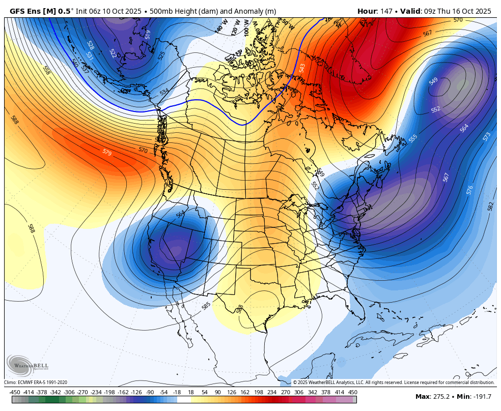
Looking ahead — the Climate Prediction Center favors cooler than normal air the next two weeks in much of the Northeast U.S., thanks to potential for an omega block setting up across the North American region.
weatherbell.com
About
Weekday morning newsletter by a journalist/forecaster. Connecting weather and climate change dots while occasionally stirring the pot.
Find this interesting? Forward it on and tell a friend!
Reply