- The Weather Retort
- Posts
- Another Mid-Atlantic flood watch and plentiful heat
Another Mid-Atlantic flood watch and plentiful heat
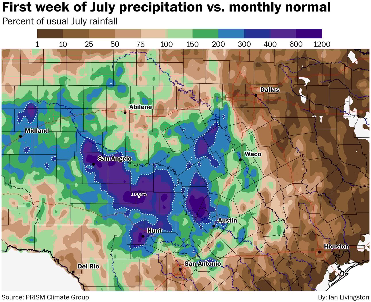
Parts of Texas have seen six to 10 Julys worth of rain in a week.
Ian Livingston
July 08, 2025
Midsummer is doing its thing in much of the Lower 48 on Tuesday, and another heat wave is set to expand over Europe. Along with high heat comes plenty of humidity and zones of heavy rainfall.
Weather Watch
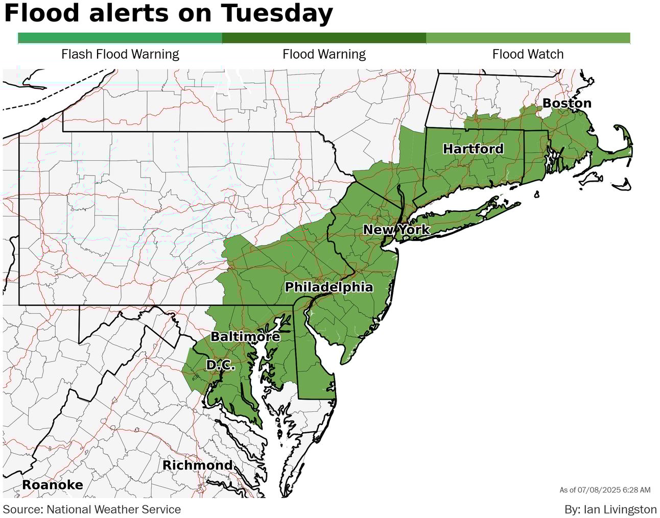
Here comes the rain again. It’s the year of the flood watch in places like my backyard, as yet another heavy rain risk looms Tuesday across the Mid-Atlantic into Southern New England. More rain is likely later this week. About 1.5 to 4 inches should be common by the weekend, with some spots potentially picking up a good deal more.
July is Julying. Extreme heat warnings are in place for parts of Arizona, California and Nevada for temperatures rising as high as 110 to 120 over coming days. Ahead of the storm-sparking cold front in the eastern U.S., heat advisories also run from eastern North Carolina to Boston for highs ranging near 90 north and upper 90s south. Denver and parts of the northern high Plains are facing hot weather, too, with highs around 100 expected Wednesday in that city.
Lightning links
Camp Mystic, where deadly Texas flooding took place, is in 'Flash Flood Alley'. (Jesse Ferrell, AccuWeather)
Third heatwave coming to the UK could be longest of the year so far. (Ben Rich, BBC)
Months and months of rain
Through July’s first week, the footprint of extreme rainfall in Texas has expanded to cover much of the central portion of the state. As of Monday morning (PRISM data below lags a bit), analysis shows as much as 10x the usual July rainfall near the precipitation maximum.
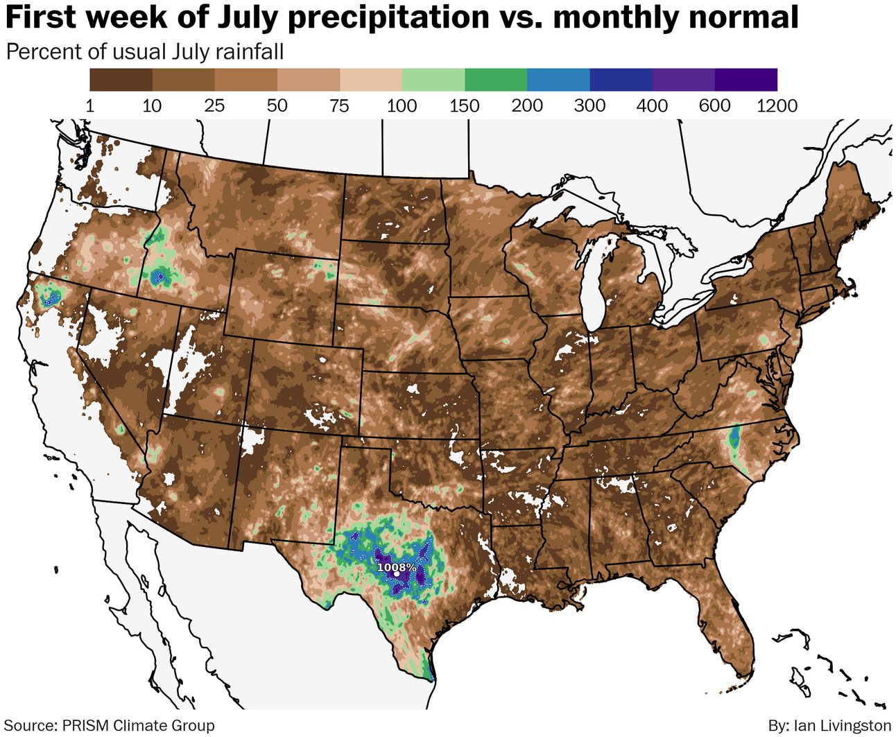
The footprint of Chantal in North Carolina can also be seen, as can a few wet spots in the northern California to Idaho region where it takes considerably less water to be well above normal.
Here’s a close-up view of Texas and the region that suffered devastating flooding. A big chunk of the total came in a much shorter period than one week.
About
Weekday morning newsletter by a journalist/forecaster. Connecting weather and climate change dots while occasionally stirring the pot.
Find this interesting? Forward it on and tell a friend!
Reply