- The Weather Retort
- Posts
- Amy slamming UK and Europe as fall heat builds in Lower 48
Amy slamming UK and Europe as fall heat builds in Lower 48
A swath of the northern Plains and Upper Midwest head for the 80s and 90s.
Ian Livingston
October 03, 2025
Damaging wind and heavy rain will lead to travel disruption and worse for portions of Europe into the weekend as Storm Amy wallops the region. In the United States, it’s a mix of summer and winter over the next several.
Weather watch
Amy attacking the UK. Storm Amy is coming together Friday as it barrels toward Ireland and the United Kingdom. It’ll torment northern Europe through the weekend, with gusts as high as around 95 mph expected, especially in Scotland or northern portions of Ireland. Code Oranges for land and red over near-shore waters are up from Met Eirenn as well as the UK Met Office.

Storm Amy is in the throes of bombing out. (Ocean Prediction Center)
Summertime heat. Temperatures around or above 90 are in Friday’s forecast from southwest South Dakota to just west of Chicago as a bit of a heat dome takes control of the region. Records will be widespread there and into southern Canada in the days to come.
Lightning links
Siberia near record cold levels for early October. (Thierry Goose)
Winter storm watches
One of my favorite parts of fall is watching the arrival of snow in the mountains, and the eventual shift into lower elevations with progression of the season.
Some of that is on tap in the Rockies.
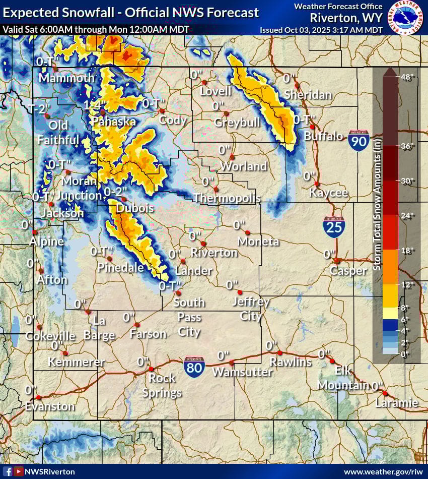
80s are forecast on the high Plains of Wyoming Friday. But portions of that state and Montana are under winter storm watch as up to 1-2 feet of snow is anticipated in the high country there this weekend.
Snow elevations dip to around 7,000 feet at times, with the most accumulation occurring above 9,000 or 10,0000 feet.
About
Weekday morning newsletter by a journalist/forecaster. Connecting weather and climate change dots while occasionally stirring the pot.
Find this interesting? Forward it on and tell a friend!
Reply